Drone or Helicopter? Questions to ask when commissioning aerial photography
We often receive enquiries to shoot drone photography for architectural visualisation, but when we open the brief, and assess the situation, a drone is not always the best solution or even viable to achieve the clients aims. Drone or helicopter?
This journal post addresses the myriad types of aerial photography and why each would be used depending on height, location, budget and other factors/restrictions. It's a go to guide to help visualisers decide what type of photography they need to commission but it should also help visualisers and clients have more productive conversations about their needs and expectations.
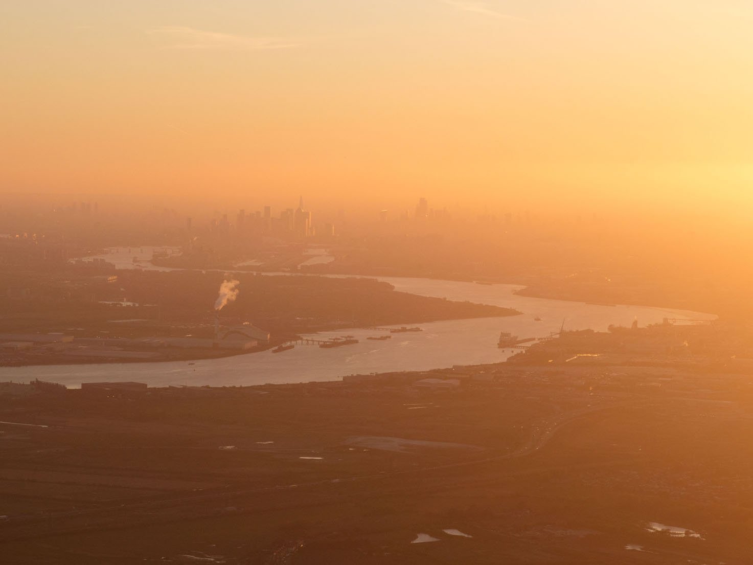
Helicopter - Looking west down the River Thames as it snakes towards central London
What is aerial photography?
Aerial photography is photography taken above eye height, this ranges from a tall tripod/pole all the way through to a drone, helicopter, plane or even a satellite.
Why is aerial photography useful in the visualisation of architecture?
Some objectives cannot be achieved from a ground perspective, for example;
/ showing off a different perspective and scale (allows the viewer to feel more powerful, looking down, god like)
/ an overview of a masterplan (allows the viewer to understand the whole scheme)
/ a detailed close up of a facade (detail not possible from the ground)
/ the ability to see multiple parts of a large scheme at once or set against the wider context of the city, infrastructure or landscape
Depending on the project, aerial photography is not always useful, however in some situations it is the only way to achieve your goals.
I want to commission aerial photography. Where should I begin?
Here are some initial questions that would be ideal to answer or think about to better understand your requirements from the photographer.
What am I trying to achieve?
This is the main question you need to ask yourself, is your scheme a masterplan and you want to see the whole site, or maybe you're working on a small roof extension but you want to see how it fits amongst the rooftops and chimneys of suburban London? Maybe you want to be fairly high so you can see your scheme in the wider setting of the city it inhabits, the size of your scheme matters because if it’s very small it will get lost the higher the camera, but if your camera is low all the buildings will concertina up. There are myriad answers to this question but you need to know what your overall goal is before proceeding.
How high is my camera position?
Logistically the most important question as it will affect what method should be pursued. As a rule up to 120 meters a drone can be used in the UK.
When is my deadline?
Some forms of aerial photography take longer to arrange and execute than others. The weather is usually a factor too, to allow for good light. The more time the better, as always. Either way it’s important to know.
Where is my location?
Important for many reasons but with regard to aerial photography, especially drone photography the location of the site is vitally important due to restricted airspace. If the photos need to be taken in restricted airspace, permissions will need to be sought and there may be much more paperwork and a longer lead in time.
What is my budget?
You need to know your budget to know what is achievable. It goes without saying that photography from a helicopter or plane costs more than drone photography, having said that drone photography can sometimes involve a lot more admin than a helicopter on the part of the photographer.
Drone - The Isle of Dogs looking north from Greenwich
What desktop tools are there to aid me in my research?
There are myriad desktop tools at your disposal to aid you in working out your photo or view before getting in touch. These will also help in defining the height of the camera and therefore helping decide the best approach.
Google Earth: Shows you the camera height and most realistic preview of what can be achieved. We use google earth to scope out views, check what they will look like at certain camera heights and prep jobs so we are aware of what to expect when we are on site. You can also look straight down once a view is set up and screen grab the camera location.
3D model: If you are working on a visual and have a 3D model this is the best way to see what the proposed scheme will look like. The downside is that if you don’t have context it’s hard to assess how it will look in the photo.
Sun Calc or Photo Ephemeris: Both useful tools to help assess where the sun will be at a given time of day. These tools provide a really quick and easy way to see when the sun will hit a certain facade.
We are always happy to advise further and help with planning specifics.
Example of Google Earth visual and Photo Ephemeris to assess sun direction
What are the most common types of aerial photography?
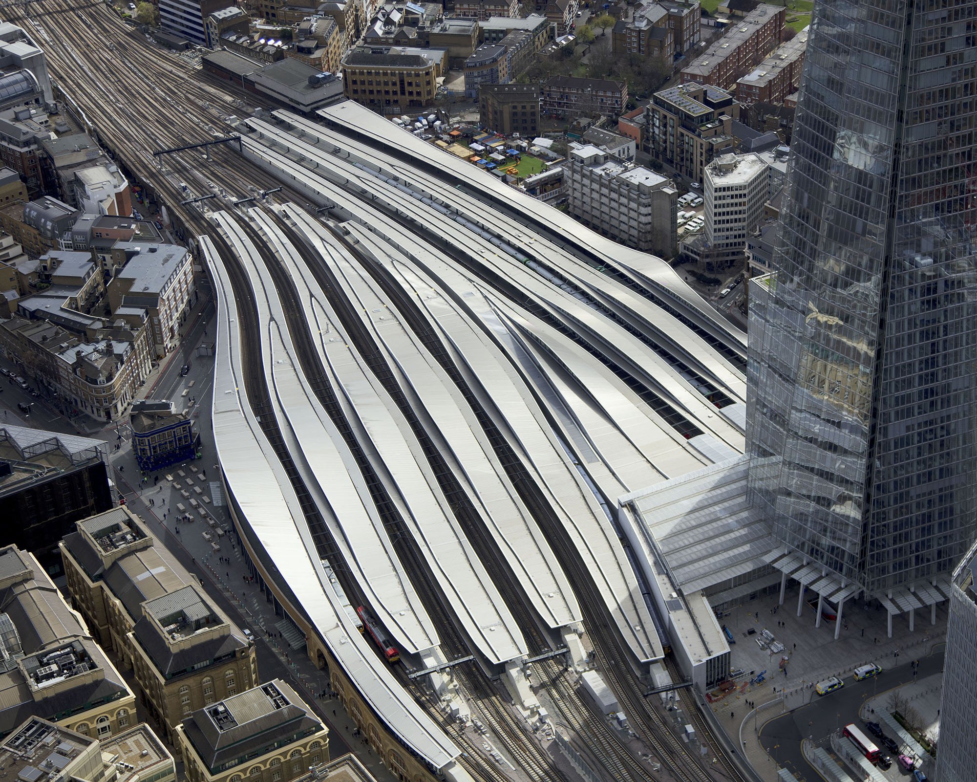
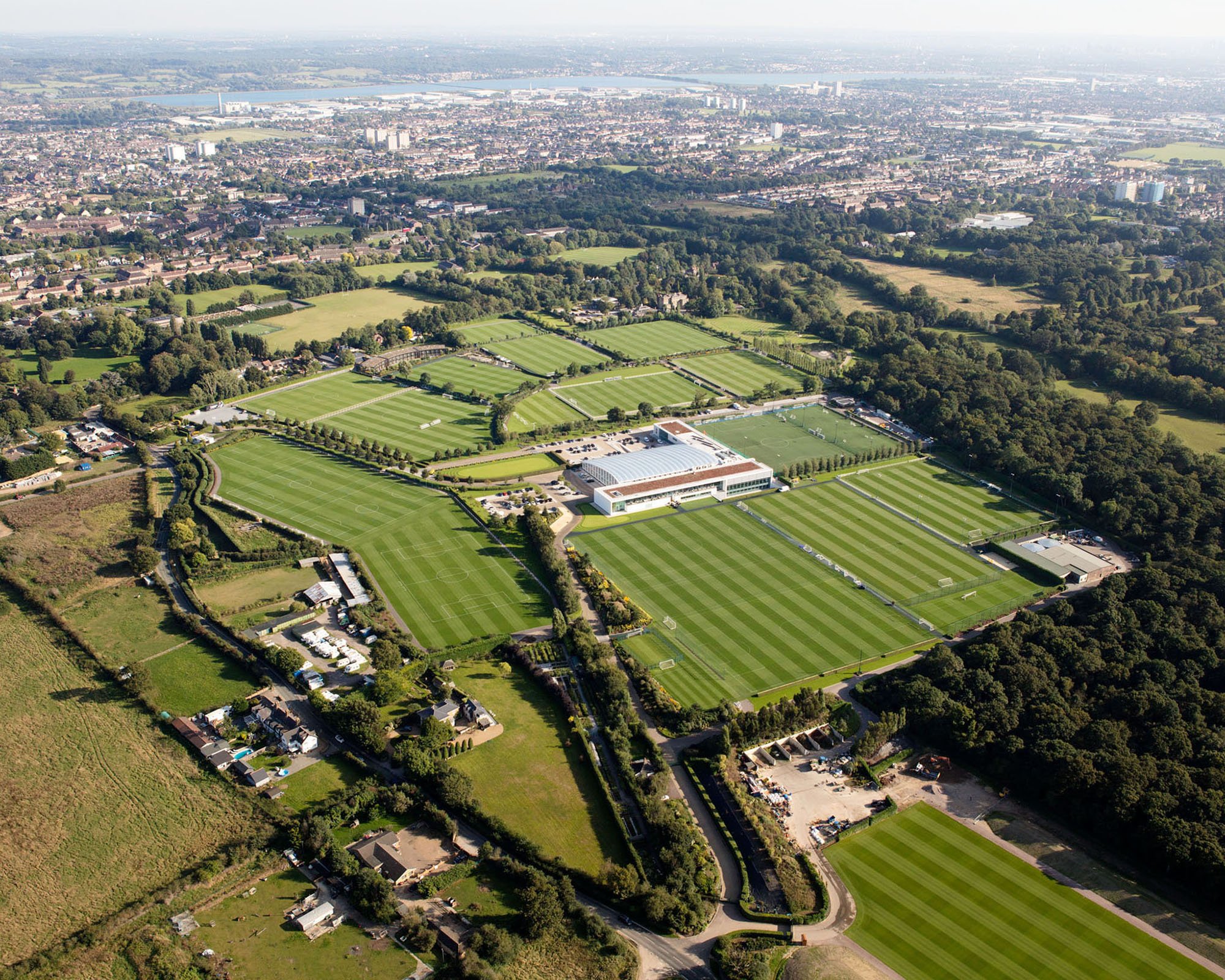
Helicopter - 230 meters upwards
London Bridge Station / Tottenham Hotspur Training Ground / Thames
Best for: over arching masterplans, whole city or larger schemes, much higher perspective to separate out buildings
Achieve: larger sense of scale, placing a project in a wider environment or city
Pros: A lot of freedom, easy to use high res camera
Cons: Most expensive option, must generally be a lot higher than other options especially in urban settings


Drone - 120 meters and below
London Bridge / Willington Cooling Towers
Best for: medium height views, views amongst buildings
Achieve: sense of scale, whole site for smaller sites
Pros: Much more flexibility in height and location compared to pole or building
Cons: Some restrictions which might involve paperwork/permissions (adding cost), height limit, can be lower res when in urban environment due to weight restriction of drone
Building
Canary Wharf / Elephant and Castle
Best for: Can be easier/cheaper and quicker than any other type of aerial photography
Achieve: Depends on height of building but usually level or amongst over buildings
Pros: No drone or helicopter restrictions, easy to use high res camera, cost effective
Cons: Very restrictive, pure luck if you can find a building at the correct height and location for the view and gain access
Pole
Oxford Street
Best for: Fairly low elevated views, such as along an urban street, over a smaller development or a house.
Achieve: Getting slightly above everything in the scene without feeling detached
Pros: No drone or helicopter restrictions, easy to use high res camera
Cons: Height limited substantially
This article is written based on our knowledge and expertise working in the UK and especially around London. It is not exhaustive and is written as a short introduction. We hope it gives you a good overview to help you assess the best route forward when commissioning aerial photography.
We are of course always happy to discuss your needs and answer further questions, get in touch below.


